You are using an out of date browser. It may not display this or other websites correctly.
You should upgrade or use an alternative browser.
You should upgrade or use an alternative browser.
Morgan again?? Just got the word can we use it again, NO WORRIES!!
- Thread starter stoozo
- Start date


Help Support Mini Dirt Bikes & Pit Bikes Forum:
This site may earn a commission from merchant affiliate
links, including eBay, Amazon, and others.
- Status
- Not open for further replies.
stoozo
Banned ****** of the Century
Yeha not too sure, i havent been oput there for a while, i mowed it about 2 weeks ago, i dont get home each night till 645 so too dark to sus, ill trya and look soon and see what its like, its good dirt, but can be very slippery when wet, but good fun
Nah the BOM is just scared, this weather will be gone by the weekend....seriously, the Blizzard is over and it will clear up until Friday with patchy rain. We'll get something local to ride!! What are you scared of getting your new plastics all muddy tigger??
Last edited:
GooseMan
Well-Known Member
gonna be f***en windy too mate, any videos you take will be all wind noise, 14 degrees plus wind chill is pretty chilly unless your a POM, besides, might be getting a brand spankin new bike this weekend or the next.....") Wouldn't mind riding on a track, never done that before....
Wouldn't mind riding on a track, never done that before....
Doesn't Jams also have a trails riding area??
Wouldn't mind riding on a track, never done that before.... Doesn't Jams also have a trails riding area??
stoozo
Banned ****** of the Century
gonna be f***en windy too mate, any videos you take will be all wind noise, 14 degrees plus wind chill is pretty chilly unless your a POM, besides, might be getting a brand spankin new bike this weekend or the next.....
Doesn't Jams also have a trails riding area??
Mate its ski season and SA is not even cold enough for it to snow, it'll be fine! Yeah not to sure about JAMS all I know is its sandy and looks rather big on google maps!!


$17.73
$19.76
BBB Cycling BBL-52 MiniSafe Compact Bicycle Lock for Mountain, Road and Racing Bikes
Amazon Global Store UK

![JOYROOM Bike Phone Holder Mount, [Anti Vibration] Bicycle Phone Mount, Dirt Bike Accessories for All 4.7-7.0" Phones, Motorcycle Phone Mount for iPhone 16 Pro Max/15/14/13/12 Samsung S25 Ultra/S24/S23](https://m.media-amazon.com/images/I/41MPtPvknUL._SL500_.jpg)


$150.99
For ATV Dirt Bike Scooter 49CC 2-Stroke Mini Complete Engine Motor With Gear Box
Eddie kaora


![LISEN Bike Phone Holder, [2025 Upgrade] Motorcycle Phone Mount, Bicycle Phone Holder, Handlebar Phone Mount, Dirt Bike Accessories, Bicycle Accessories, for iPhone Samsung Google Pixel, Black](https://m.media-amazon.com/images/I/41FJGrZQ5ML._SL500_.jpg)


![Zewdov Motorcycle Phone Mount, Upgrade Bike Phone Mount [1s Lock][Secure Protection], 360° Rotatable Phone Holder for Mountain Bike/ATV/Scooter Handlebar, Compatible with iPhone/Samsung 4.7-6.7"](https://m.media-amazon.com/images/I/51lvX8e2C3L._SL500_.jpg)
stoozo
Banned ****** of the Century
Yeah will have to wait until no rain is forecast Sneezy. apparently there is another storm tonight...but I can see stars must be the bom freaking out like they do everytime they miss a storm warning until an hour before it hits...
Sent from my WT19i using Tapatalk
Sent from my WT19i using Tapatalk
stoozo
Banned ****** of the Century
Except the severe weather warning at 7.53pm...
Sent from my WT19i using Tapatalk
Sent from my WT19i using Tapatalk
Read it, Its says friday.
For people in the Adelaide Metropolitan, Mount Lofty Ranges, Lower Eyre Peninsula, Eastern Eyre Peninsula, Yorke Peninsula, Kangaroo Island, Mid North, Riverland, Murraylands, Upper South East, Lower South East and parts of the West Coast and Flinders districts.
Issued at 7:53 pm Thursday, 26 June 2014.
A large and deep low pressure system will track south of the State during Friday. An associated strong front is expected to affect Eyre Peninsula and Kangaroo Island Friday morning, the Adelaide area and South East coast during the afternoon and the eastern border Friday evening. Locally heavy showers and thunderstorms to accompany the front with further showers to follow.
Strong northwesterly winds may become locally damaging with gusts of 90-100 km/h over parts of southern Eyre and Yorke Peninsulas, Kangaroo Island and the southern Mount Lofty Ranges from early Friday. Winds are likely to reach gale force, averaging 50-70 km/h in elevated areas and on the eastern slopes of the Mount Lofty Ranges.
Damaging northwest to westerly winds with gusts in excess of 90 km/h are then expected to spread eastwards across the warning area during Friday, affecting the Adelaide area during the afternoon and eastern districts in the evening. The damaging winds are most likely to occur near the front and with showers or thunderstorms.
Locations which may be affected include Adelaide, Victor Harbor, Port Lincoln, Maitland, Clare, Murray Bridge, Keith and Mount Gambier.
The State Emergency Service advises that people should:
* Move vehicles under cover or away from trees;
* Secure or put away loose items around your property.
* Stay indoors, away from windows, while conditions are severe.
The next warning is due to be issued by 10:55 pm.
Warnings are also available through TV and Radio broadcasts, the Bureau's website at Australia's official weather forecasts & weather radar - Bureau of Meteorology or call 1300 659 215. The Bureau and State Emergency Service would appreciate warnings being broadcast regularly.
stoozo
Banned ****** of the Century
Yep thanks I missed that bit...well they're getting in early this time! So Sunday won't be raining but things will be nice and soggy!
Sent from my WT19i using Tapatalk
Sent from my WT19i using Tapatalk
stoozo
Banned ****** of the Century
Yep this front coming through is the one the victorians are worried about. But it should still hit hard here.
Ah so thats why early warming....going to hit Melbourne....not even the bom cares if we get destroyed in a storm...funny stuff!
Sent from my WT19i using Tapatalk
stoozo
Banned ****** of the Century
Wow what a ****ty day for a ride....Blue sky, bit of cloud has drizzled twice since 10am.....Im pretty close to giving up on this gig might just start hanging around with Sneezy and the boys who actually want to ride....1-5mm forecast at Morgan....5mm of rain, that wont even register in the rain guage. Backyard time!!
stoozo
Banned ****** of the Century
2 hrs north.....rain is a pass up there.....2.4mm in Morgan this whole week....this is why when it used to rain in Adelaide we'd do a road trip to victor park with the BMXs....9 times out of 10, 60km from Adelaide in any direction and hte weather will be better as the Mt Lofty ranges will catch most of it and its barren on the other side.... :hache:
Morgan Rainfall, SA 5320 - WillyWeather
Morgan Rainfall, SA 5320 - WillyWeather
There isn't a weather station in morgan so localised falls are'nt to accurate, they get there data from elsewhere just like weatherzone and the bom.
Get out the house, go for a drive with the bike in the back and if you find somewhere great, if not you've had a nice drive.:first:
Get out the house, go for a drive with the bike in the back and if you find somewhere great, if not you've had a nice drive.:first:
stoozo
Banned ****** of the Century
There isn't a weather station in morgan so localised falls are'nt to accurate, they get there data from elsewhere just like weatherzone and the bom.
Get out the house, go for a drive with the bike in the back and if you find somewhere great, if not you've had a nice drive.:first:
**** that its cold and windy....plus my ski jacket is in the wash, could use my other one though, nah petrol is to expensive to aimlessly drive around hoping someone else will crash into my ute and dent it up some more... :thumbup:
Last edited:
my67xr
Miniriders Legend and Master Spanner Spinning Mode
lucky i didn't say yeah we were going,
Cj was home from school yesterday sick, he was up most of the night from thursday evening with Croup.
he's still crook now, and it's really hard keeping him inside as you'd know!
Cj was home from school yesterday sick, he was up most of the night from thursday evening with Croup.
he's still crook now, and it's really hard keeping him inside as you'd know!
stoozo
Banned ****** of the Century
lucky i didn't say yeah we were going,
Cj was home from school yesterday sick, he was up most of the night from thursday evening with Croup.
he's still crook now, and it's really hard keeping him inside as you'd know!
Make him wear some freaking clothes then. He was running around the other day in a t-shirt and its 15 degrees if it wasnt blowing 20km/hr winds, which makes it about 5 degrees....I think CJ is out of weekend trips until he gets older, with his health honestly, he'll hate me for it but it is what it is...yeah I dunno Im pretty close to giving up really, I put time and effort into this and no one really seems to get that either....I know you do a lot for miniriders Craig but organising rides in SA is really like hitting your head on a brick wall all day....I used to go skiing and camp 10km from the top of the Mtn in a tent, grew up playing footy, not so much fun in shorts and no sleeves in sideways rain for 2hrs, have to run to the sidelines to get someone to tie up your shoe laces for you cause your fingers are locked solid...This is drizzle....thats just how I think, weather has never got in the way of me having a good time, I guess I figure people who ride dirt bikes are the same.....maybe BMX at the concrete skate park is out in the rain, ive tried its worse than ice....but motorbikes designed to ride off road???
stoozo
Banned ****** of the Century
I guess I wouldnt have got a $120 camping chair for $15 at Lions mart today if we went....not that I had the $15 but we needed a toaster too, so $20 for both!
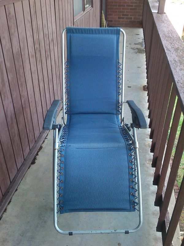
So its pretty much this, no head rest...but not a problem. Might need some elastics fixed soon but also not a problem!!
Folding SUN Lounge Reclining Tanning Pool BED Outdoor Camping ARM Chair Black | eBay

So its pretty much this, no head rest...but not a problem. Might need some elastics fixed soon but also not a problem!!
Folding SUN Lounge Reclining Tanning Pool BED Outdoor Camping ARM Chair Black | eBay
- Status
- Not open for further replies.